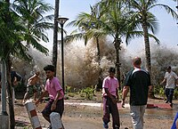
Photo from wikipedia
The 2016 Fukushima normal-faulting earthquake (Mjma 7.4) occurred 40 km off the coast of Fukushima within the upper crust. The earthquake generated a moderate tsunami which was recorded by coastal tide… Click to show full abstract
The 2016 Fukushima normal-faulting earthquake (Mjma 7.4) occurred 40 km off the coast of Fukushima within the upper crust. The earthquake generated a moderate tsunami which was recorded by coastal tide gauges and offshore pressure gauges. First, the sensitivity of tsunami waveforms to fault dimensions and depths was examined and the best size and depth were determined. Tsunami waveforms computed based on four available focal mechanisms showed that a simple fault striking northeast-southwest and dipping southeast (strike = 45°, dip = 41°, rake = −95°) yielded the best fit to the observed waveforms. This fault geometry was then used in a tsunami waveform inversion to estimate the fault slip distribution. A large slip of 3.5 m was located near the surface and the major slip region covered an area of 20 km × 20 km. The seismic moment, calculated assuming a rigidity of 2.7 × 10¹⁰ N/m2 was 3.70 × 10¹⁹ Nm, equivalent to Mw = 7.0. This is slightly larger than the moments from the moment tensor solutions (Mw 6.9). Large secondary tsunami peaks arrived approximately an hour after clear initial peaks were recorded by the offshore pressure gauges and the Sendai and Ofunato tide gauges. Our tsunami propagation model suggests that the large secondary tsunami signals were from tsunami waves reflected off the Fukushima coast. A rather large tsunami amplitude of ~75 cm at Kuji, about 300 km north of the source, was comparable to those recorded at stations located much closer to the epicenter, such as Soma and Onahama. Tsunami simulations and ray tracing for both real and artificial bathymetry indicate that a significant portion of the tsunami wave was refracted to the coast located around Kuji and Miyako due to bathymetry effects.
Journal Title: Pure and Applied Geophysics
Year Published: 2017
Link to full text (if available)
Share on Social Media: Sign Up to like & get
recommendations!