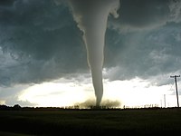
Photo from wikipedia
Flash flood and related hazards occurred over the Haor (wetland) areas of northeast Bangladesh during 17–18 April 2010. Prediction of this sudden incident is challenging when it happened on the… Click to show full abstract
Flash flood and related hazards occurred over the Haor (wetland) areas of northeast Bangladesh during 17–18 April 2010. Prediction of this sudden incident is challenging when it happened on the high terrain of Meghalaya Plateau and adjoining Bangladesh. Flash flood event occurred when convective cells assembled into a mesoscale convective system (MCS) over the steep edge of the Plateau. The MCS obtained its extreme point after getting moisture support from the southerly flow of the Bay of Bengal (BoB). This study investigated the synoptic flow patterns and large-scale characteristics of the flash flood-producing storm and its associated tropospheric conditions in northeast Bangladesh using the Weather Research and Forecasting (WRF) model. The model used a 3-nested domain with the horizontal resolution of 27 km, 9 km, and 3 km, respectively. The study revealed that the model underestimated the strength of the flash flood in general in respect of rainfall. The 48-h simulated rainfall was about 152 mm for outer domain-1, about 195 mm for inner domain-2 and about 209 mm for the innermost domain-3 whereas actual rainfall was 223 mm as recorded by Bangladesh Meteorological Department (BMD). The southerly wind was strong at 950 hPa and the westerly wind prevailed at 500 hPa level. The model simulated results show that cloud water mixing ratio was 1.8 mg m−3 and extended vertically up to 17 km. Ice water mixing ratio was 200 mg m−3 and found in between 12 and 20 km, indicating the formation of ice in the upper troposphere. The maximum values of x, y, and z-wind components over Cherrapunji were − 11 ms−1, − 21 ms−1 and − 2.8 ms−1, respectively which indicated the strengthening of the convective system to produce flash flood.
Journal Title: Meteorology and Atmospheric Physics
Year Published: 2019
Link to full text (if available)
Share on Social Media: Sign Up to like & get
recommendations!