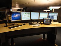
Photo from wikipedia
The occurrence of disasters such as extreme flooding in urban environments has severe consequences, not only on the human population but also on critical infrastructures such as the road networks,… Click to show full abstract
The occurrence of disasters such as extreme flooding in urban environments has severe consequences, not only on the human population but also on critical infrastructures such as the road networks, which are of vital importance for everyday living and particularly for emergency response. In this article, our main goal is to present-conceptually and in praxis-a model that could be used from the emergency responders for timely and efficient emergency management and response in an urban complex environment. For the city of Cologne in Germany, we aim to indicate possible ways to decrease the emergency response time during an extreme flood scenario through the development of an accessibility indicator, which consists of different components. Therefore, we will investigate the opportunities that occur, in a flood risk scenario, from the use of geographic information in different forms such as Volunteered Geographic Information (VGI) and open-source data in an ArcGIS environment, to increase urban resilience through the decreasing emergency response time. We will focus on network analysis for the fire brigades (first acting emergency responders) during a flood scenario to calculate their emergency response ranges and emergency response routes through flooded road networks, for the assistance of the possibly affected hospitals, refugee homes and fire brigades, which can be flooded. At the end of the paper, we suggest that the vulnerable community of the refugees could be taken into consideration as a new source of VGI, as an additional component that would lead to the decrease in the emergency response time. The geo-located information that could be provided by the refugee community can be very useful in emergency situations, such as those examined in this article where timely information can be forwarded to the proper authorities for a more focused and timely emergency response, increasing the resilience of the urban population and their community.
Journal Title: Natural Hazards
Year Published: 2017
Link to full text (if available)
Share on Social Media: Sign Up to like & get
recommendations!