Photo from wikipedia
Development and application of offshore wind turbine farms have been increasing, particularly in the developed countries, because of their high power rating, high yield energy, high offshore wind, and unlimited… Click to show full abstract
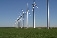
Development and application of offshore wind turbine farms have been increasing, particularly in the developed countries, because of their high power rating, high yield energy, high offshore wind, and unlimited space in the offshore. However, the poor data and simplistic methodologies of the previous assessments result in insufficient estimates of the wind energy potential. Thus, this study provides an assessment of the offshore wind energy resources in Malaysia using multi-mission satellite altimetry data. The satellite altimetry data was extracted from Radar Altimeter Database Systems located at GNSS and Geodynamics Laboratory, Universiti Teknologi Malaysia. The data were validated by buoy measurements from two offshore sites, as indicated by the high correlation coefficient of 0.88. Further, the offshore wind energy resource mapping data in Malaysia identified three areas in Peninsular Malaysia and Borneo as potential areas for offshore wind energy development.
Journal Title: Journal of Marine Science and Application
Year Published: 2019
Link to full text (if available)
Share on Social Media: Sign Up to like & get
recommendations!