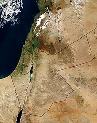
Photo from wikipedia
Wadi Feiran is an important drainage basin in southern Sinai Peninsula covering an area of about 1785 $$\hbox {km}^{2}$$km2, its streams drain into the Gulf of Suez crossing variety of rocks… Click to show full abstract
Wadi Feiran is an important drainage basin in southern Sinai Peninsula covering an area of about 1785 $$\hbox {km}^{2}$$km2, its streams drain into the Gulf of Suez crossing variety of rocks and sedimentary units varied in age from Precambrian to Quaternary. Field investigations, geographic information systems (GIS) and remote sensing studies including Landsat-7 ETM+, Radarsat-1, and SRTM DEM were integrated to reveal its lithologic, geologic and geomorphic features. Besides the field investigations, rock units including basement and pre- and syn-rift sedimentary units were discriminated using band ratios and principal component analysis techniques (PCA). Such techniques revealed that the crystalline rocks covering W. Feiran are unaltered rocks lacking OH-bearing minerals. Radar data successfully displayed the structures and geomorphic features related to topography. Moreover, the techniques allowed the extraction of the dyke-like structures along faults and shear zones. This also characterized the topographic variations through analysis of the shaded terrain and the altitudinal profiles. The results of data integration, lineament analysis and lineament density maps revealed that the structural grain in the present study has four different trends: N20–45E, N30–45W, N–S and E–W. Based on analysis of radar data and geomorphic indices, W. Feiran is an asymmetrical basin, its left side occupies $$\sim $$∼34% of the total area that leads to a supposedly massive tilt towards the south which caused the southwestward slope.
Journal Title: Journal of Earth System Science
Year Published: 2017
Link to full text (if available)
Share on Social Media: Sign Up to like & get
recommendations!