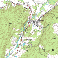
Photo from wikipedia
Topography underpins natural processes ranging from incident solar radiation to overland flow and water pooling. Despite the influence of topography on natural processes, especially in wetland ecosystems reliant on uplands… Click to show full abstract
Topography underpins natural processes ranging from incident solar radiation to overland flow and water pooling. Despite the influence of topography on natural processes, especially in wetland ecosystems reliant on uplands for water inputs, topography has not been adequately incorporated into reclamation planning. Instead, wetland reclamation projects are typically guided by height-to-length ratios that produce little resemblance to natural wetlands. We present a methodology to quantify the topographic characteristics in landscapes with an abundance of wetlands to guide the reclamation of naturally appearing and self-sustaining wetlandscapes. Topographic characteristics in over 3000 sample landscapes were quantified using terrain roughness and landform element composition and configuration. A large set of metrics was reduced to a statistically independent subset that was applied and compared across three natural regions and a gradient of disturbance. Our results showed that surface roughness and landform element patterns significantly differ among natural regions and that high disturbance landscapes significantly differ from other disturbance levels. To ensure reclaimed wetlandscapes are naturally appearing and self-sustaining, they should replicate the topographic characteristics found within the distribution of surrounding natural landscapes by applying topographic characteristic benchmarks to reclamation design. The presented methodology can be used as a step towards achieving this goal.
Journal Title: Wetlands
Year Published: 2019
Link to full text (if available)
Share on Social Media: Sign Up to like & get
recommendations!