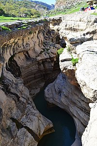
Photo from wikipedia
A considerable proportion of Iran’s territory is covered with arid and semi-arid rangelands and mismanagement and overexploitation of those rangelands have resulted in serious ecological degradation. Thus, the need is… Click to show full abstract
A considerable proportion of Iran’s territory is covered with arid and semi-arid rangelands and mismanagement and overexploitation of those rangelands have resulted in serious ecological degradation. Thus, the need is pressing to examine the present species composition and the relationships with environmental factors for providing the needed scientific references to species conservation and ecological rehabilitation efforts. The aims of this study were to examine the species composition and to delineate the most important factors influencing the distributions of plant species and groups in the northern rangelands of Isfahan Province (Iran) using two-way indicator species analysis (TWINSPAN), detrended correspondence analysis (DCA), principal component analysis (PCA), and canonical correspondence analysis (CCA). Field investigations were conducted in the growing season of 2014 using stratified random method in 22 homogeneous sampling units. In total, 75 plant species belonging to 52 genera and 19 families were identified. The most important families were Asteraceae and Papilionaceae, the most important genera were Astragalus, Cousinia, and Acanthophyllum, and the most important species were Artemisia aucheri and Artemisia sieberi. Plant species were classified into 10 groups using TWINSPAN. DCA was used to estimate the magnitude of changes in species composition along the first two ordination axes to provide gradient length estimations for PCA and CCA ordinations. The first three PCA axes and the first three CCA axes demonstrated similar cumulative percentage of variance, indicating that the environmental factors (selected by PCA) used in CCA ordination were acceptable for explaining the species composition and the distributions. CCA ordination showed that the first axis was closely related to elevation, slope, surface bare soil cover, surface litter cover, gravel proportion, organic matter, total nitrogen, CaCO3 content, and grazing intensity and that the second axis was closely related to sand proportion, silt proportion, clay proportion, and saturation percentage. Among these factors, elevation was the most effective factor to separate the plant groups and grazing was the major cause of rangeland degradation.
Journal Title: Journal of Arid Land
Year Published: 2017
Link to full text (if available)
Share on Social Media: Sign Up to like & get
recommendations!