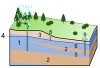
Photo from wikipedia
To solve the problems of decreasing water resources from the Yellow River, the renovation project of water-saving and controlling water distribution was implemented in the Hetao Irrigation District of North… Click to show full abstract
To solve the problems of decreasing water resources from the Yellow River, the renovation project of water-saving and controlling water distribution was implemented in the Hetao Irrigation District of North China since 1999. The local hydrological cycle is expected to be influenced or changed during the past fifteen years through the project. Jiefangzha Irrigation Region, the second large partition of the Hetao Irrigation District, was selected as the typical area to explore the relationship between agricultural water consumption, water distribution, cropping pattern and changing groundwater level. In this paper, the SEBS (Surface Energy Balance System) model and the ESTARFM (Enhanced Spatial and Temporal Adaptive Reflectance Fusion Model) algorithm were applied to produce daily field-scale evapotranspiration (ET) based on Landsat and MODIS data from 2000 to 2015 at intervals. The results indicate that the cropping pattern had changed greatly, while the water table descended through the years. The total agriculture ET stayed relatively stable, with the average annual consumption of 8.9×10⁸m3. The temporal variation of agriculture ET was not obviously sensitive to the adjustment of cropping pattern. There was no significant difference in April–October ET for different crops, in spite of the clear distinction of ET in each crop-specific growing season. The spatial distribution of agricultural ET did not change in spite of the great adjustment of cropping pattern during fifteen years, which has a close inverse correlation with the groundwater depth. Groundwater depth descended from 1.76m to 2.33m during the operation period of the water-saving project, which might reduce the soil evaporation and have a positive effect on soil salinization effectively. Meanwhile, the net irrigation water use efficiency was improved from 0.59 to 0.66. These effects indicate the positive impact of the implemented water-saving renovation project on water management and environment. However, the actual crop coefficient Kc,a decreased slightly with the gradually increasing reference evapotranspiration, indicating possible drought stress as an effect of the continuing reduction of the availability of net irrigation water and declining groundwater table.
Journal Title: Agricultural Water Management
Year Published: 2017
Link to full text (if available)
Share on Social Media: Sign Up to like & get
recommendations!