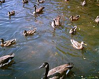
Photo from wikipedia
Abstract One important issue in wildlife conservation is the identification of the groups of species that need greater conservation measures. In this regard, maps of habitat degradation are useful tools.… Click to show full abstract
Abstract One important issue in wildlife conservation is the identification of the groups of species that need greater conservation measures. In this regard, maps of habitat degradation are useful tools. However, water bird habitat mapping in wetland ecosystem is difficult due to the large extent and complexity of wetlands and the narrow boundary between the habitats of different groups. In this paper, the capabilities of synthetic aperture radar (SAR) data were applied to overcome these limitations and to provide a practical scheme to conserve water bird habitats. The significance of this paper is the novel application of the SAR capabilities for water bird habitat conservation. These data were used to separate the habitat of the three water bird groups and to determine the destroyed habitats that should be protected for water birds in wetlands with unstable conditions. Using Sentinel-1 (S1) data, habitat maps for the water birds were created during the inundation period in the Hamoun-e-Hirmand. These habitats included the shrub swamps, flooded meadows, and open water. Based on the four-month flooded period of the wetland and the S1 image archive, habitat maps were created for six dates. The SAR backscattering coefficients of these three habitat classes were first analyzed to investigate the potential of the S1 images to differentiate between the habitat classes. A support vector machine (SVM) was then developed to separate the habitat classes. The accuracy of the six produced maps was calculated to be between 81% and 87.5%, which confirmed the ability of the S1 images to differentiate between water bird habitat classes. Based on the habitat degradation analysis, Anatidae, Charadriiformes, Ciconiiformes, Gruidae, Pelecanidae and the diving ducks need greater conservational measures in their feeding habitats (flooded meadow and open water). This paper introduced S1 data as an effective tool for mapping the habitats of each group of water birds in a wetland.
Journal Title: Ecological Engineering
Year Published: 2020
Link to full text (if available)
Share on Social Media: Sign Up to like & get
recommendations!