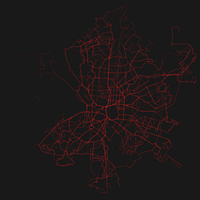
Photo from wikipedia
Public transportation agencies are one of the industries that generate a large volume of data on a high frequency and velocity basis. The General Transit Feed Specification (GTFS) is one… Click to show full abstract
Public transportation agencies are one of the industries that generate a large volume of data on a high frequency and velocity basis. The General Transit Feed Specification (GTFS) is one of the datasets these agencies generate and share openly with the public. GTFS feeds contain data for scheduled transit service including stop and route locations, and schedules information. This paper aims to demonstrate the potential of GTFS data, specifically, the paper describes the development of a GTFS data visualization tool that displays spatial and temporal patterns of transit services from which qualitative information and insights can be gained. In this paper, GTFS data from Calgary Transit was used as a case study. Previous studies focused on the development of visualization tools that display transit movement, or static graphical representation of transit operation. However, there is still a need for a dynamic interactive visualization tool that can also measures and displays transit system operation geographically and statistically. This study builds on the previous investigations and further develops a new public transit system operation visualization tool (called PubtraVis) with six visualization modules that reflect on different transit system operational characteristics; mobility, speed, flow, density, headway, and analysis. The user can evaluate two modules side by side for comparative analysis. The analysis module provides an insightful statistical summary and similarity measure and clustering results based on the transit operation characteristics. PubtraVis was tested with real-world users through a user experience study from which it was found to be useful and easy to start using. PubtraVis can be a useful tool to demonstrate the dynamism of transit vehicles from the entire transit network at a glance, and can be used to facilitate communication between transit operators, city authorities, and the general public regarding the public transit planning and operation.
Journal Title: Heliyon
Year Published: 2020
Link to full text (if available)
Share on Social Media: Sign Up to like & get
recommendations!