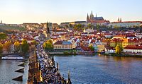
Photo from wikipedia
Identification, analysis and assessment of changes in the urbanised landscape, one of the most conspicuous transforming parts of earth surfaces, has become the topic of numerous research projects. However, there… Click to show full abstract
Identification, analysis and assessment of changes in the urbanised landscape, one of the most conspicuous transforming parts of earth surfaces, has become the topic of numerous research projects. However, there is still a lack of compatible data suitable for the generation of topical information about the urbanised landscape and its changes at different scales. An important contribution in this sense is the Urban Atlas (UA) Project pursued under the GMES (Global Monitoring for Environment and Security)/Copernicus Land (GIO land) Programme auspiced by the European Commission. The aim of this study is to document, examine and compare land use/cover change (LUCC) of the LUZs (Large Urban Zones) of Bratislava and Prague in 2006–2012 by means of the UA data and show how these changes are captured in official statistical data. Results confirmed the present trends in modern industrial cities dominating by transforming the agricultural land into residential and industrial areas. Dispersion of the urban fabric into locations previously used for agriculture was mostly widespread in LUZ Prague (1,718 ha). This trend has also been partially confirmed by the change of agricultural land in favour of construction sites, the most pronounced one in LUZ Bratislava (580 ha). Assessment and comparisons of LUCC changes of LUZs Bratislava and Prague proved that combining the UA data and official statistical data has a great potential for insight into the dynamics of the urbanised landscape of Europe.
Journal Title: Land Use Policy
Year Published: 2017
Link to full text (if available)
Share on Social Media: Sign Up to like & get
recommendations!