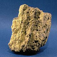
Photo from wikipedia
Abstract A number of volcanic-type uranium deposits occur in Pucheng district, Fujian province, China. Structural controls and volcanic rocks clearly explain the uranium mineralization in this area. To explore the… Click to show full abstract
Abstract A number of volcanic-type uranium deposits occur in Pucheng district, Fujian province, China. Structural controls and volcanic rocks clearly explain the uranium mineralization in this area. To explore the subtle spatial associations of uranium occurrences with certain geological features, these uranium deposits were subjected to L–function, Fry, and fractal analyses. The results reveal that (1) these deposits are clustered, have a bifractal distribution, and are spatially parallel to the NE-striking faults, (2) the regional-scale NE-striking, and prospect-scale NE-, and NW-striking faults exhibit significant spatial associations with uranium deposits as illustrated by the Fry models; (3) intersections of the faults with larger permeability and connectivity promote the mineralization process, and (4) the spatial complexities of structures and lithological contacts, quantified by the fractal dimension, form strong and positive correlations with uranium occurrences and sizes. Finally, by integrating nine spatial evidential layers representing the controlling factors for the occurrence of mineralization, the artificial neural network model was applied to map mineral prospectivity for the uranium mineralization. The receiver operating characteristics (ROC) curve and the under the ROC curve (AUC) were utilized to measure the performance of the prospectivity models. The model is highly capable of mapping uranium prospectivity because the AUC is greater than 0.5 and close to 1. The prospectivity mapping confirmed that there is significant potential for uranium mineralization in the study area, which opens up new avenues for further explorations on uranium deposits in Pucheng district.
Journal Title: Ore Geology Reviews
Year Published: 2019
Link to full text (if available)
Share on Social Media: Sign Up to like & get
recommendations!