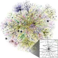
Photo from wikipedia
Abstract Regions are subdivisions of the earth’s surface, and many systems of regionalization were proposed. Recently, with the availability of geotagged data, it raises the question of whether regions formed… Click to show full abstract
Abstract Regions are subdivisions of the earth’s surface, and many systems of regionalization were proposed. Recently, with the availability of geotagged data, it raises the question of whether regions formed by human interactions agree with government districts. Thus, using network partitioning method with spatial constraint, we derive regional delineations at different spatial scales and examine their agreement with administrative districts. Experiments were conducted using the social media data of Shenzhen, China. Aggregately, the results show that the derived regions become inconsistent with administrative districts by increasing the spatial effect value, which can be largely attributed to the involvement of long human movements. However, the regions tend to keep stable when more long edges are included, which suggests the limitation of long movements effect. Individually, most northern administrative districts display high inconsistency with the derived regions, whereas most southern districts show high consistency. Besides, regions far from the downtown are less connected to the rest of the city, regions near the downtown are more connected, and particularly, regions in Nanshan, Futian, and Luohu are highly connected with each other, which form the backbone of total flows irrespective of spatial effect value. The results were finally validated at specific areas and compared with those using other methods, another dataset, and different spatial units, which suggest the feasibility of our regions for decision making in urban planning and management.
Journal Title: Physica A: Statistical Mechanics and its Applications
Year Published: 2019
Link to full text (if available)
Share on Social Media: Sign Up to like & get
recommendations!