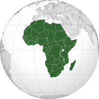
Photo from wikipedia
Abstract River basins are an extremely important source of freshwater for Africa and the impact of climate change on these communities constitutes an important question worth studying. Among these basins,… Click to show full abstract
Abstract River basins are an extremely important source of freshwater for Africa and the impact of climate change on these communities constitutes an important question worth studying. Among these basins, the Niger River Basin is an ideal candidate for meso-level theory testing of climate change-induced political violence because of its importance as one of the largest sources of freshwater in Africa, its high vulnerability to climate change, and its location in a politically unstable region. This paper utilizes the benefits of GIS to test whether effects of water insecurity on the various incidences of political violence are conditional on economic, geographic, and social means of connectivity. Our analysis uses the density of secondary road networks, the geographic distance to the Niger River, and a shared co-ethnicity with one's head-of-state to evaluate the impact of hydrological stress and its subsequent risk for political violence across nine West African countries from 1997 to 2012. Using climatological data and an econometric de-trending method, we measure the separate, substantive impact that individualized changes in precipitation trend and precipitation variability have for the incidence of ACLED's political violence events, conditional on local economic, geographic, and social factors. Our results reveal a complicated web of circumstances under which certain forms of political violence are more/less likely to be observed. The implications of this analysis serve as a call for a closer inspection of the micro-channels by which climate stress impacts heterogeneous communities in the developing world.
Journal Title: Political Geography
Year Published: 2017
Link to full text (if available)
Share on Social Media: Sign Up to like & get
recommendations!