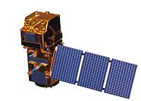
Photo from wikipedia
Abstract Satellite Synthetic Aperture Radar (SAR) is an operational tool for monitoring and assessment of oil spills. Satellite SAR has primarily been used to detect the presence/absence of oil, yet… Click to show full abstract
Abstract Satellite Synthetic Aperture Radar (SAR) is an operational tool for monitoring and assessment of oil spills. Satellite SAR has primarily been used to detect the presence/absence of oil, yet its ability to discriminate oil emulsions within a detected oil slick has not been fully exploited. Additionally, one of the challenges in the past has been the ability to deliver strategic information derived from satellite remote sensing in a timely fashion to responders in the field. This study presents methods for the rapid classification of oil types and estimated thicknesses, from which information about thick oil and oil emulsions (i.e., “actionable” oil) can be delivered in an operational timeframe to responders in the field. Experiments carried out at the OHMSETT test facility in New Jersey demonstrate that under specific viewing conditions, a single polarization satellite SAR image can record a signal variance between thick stable emulsions and non-emulsified oil. During a series of field campaigns in the Gulf of Mexico with in situ measurements of oil thickness, multiple satellite data were obtained including fully polarimetric C-band SAR imagery from RADARSAT-2 and multispectral imagery from ASTER and WorldView-2. One campaign included the airborne polarimetric UAVSAR L-band sensor. An oil/emulsion thickness classification product was generated based on RADARSAT-2 polarimetric imagery using entropy and the damping ratio derivations. Herein, we present the classification methods to generate oil thickness products from SAR, validated by sea-truth observations, the multispectral imagery, and the UAVSAR data. We tested the ability to deliver these products with minimum latency to responding vessels via NOAA. During field operations in the Gulf of Mexico, a satellite SAR-based product of oil delineation by relative thickness was delivered to a responding vessel 42 min after the RADARSAT-2 data acquisition. This proof-of-concept test using satellite SAR and multispectral imagery to detect emulsions and deliver a derived information product to a vessel in near-real-time points directly to methods for satellite-based assets to be used in the near future for oil spill tactical response operations.
Journal Title: Remote Sensing of Environment
Year Published: 2020
Link to full text (if available)
Share on Social Media: Sign Up to like & get
recommendations!