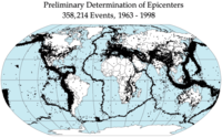
Photo from wikipedia
A significant amount of the ongoing shortening between the Eurasian and Arabian plates is accommodated within the Zagros Fold‐Thrust Belt. However, the spatial and temporal distribution of active shortening within… Click to show full abstract
A significant amount of the ongoing shortening between the Eurasian and Arabian plates is accommodated within the Zagros Fold‐Thrust Belt. However, the spatial and temporal distribution of active shortening within the belt, especially in its NW part, is not yet well constrained. We determined depositional ages of uplifted river terraces crossing the belt along the Greater Zab River using luminescence dating. Kinematic modeling of the fault‐related fold belt was then used to calculate long‐term slip rates during the Late Pleistocene to Holocene. Our results provide new insight into the rates of active faulting and folding in the area. The Zagros Mountain Front Fault accommodates about 1.46 ± 0.60 mm a−1 of slip, while a more external basement fault further to the SW accommodates less than 0.41 ± 0.16 mm a−1. Horizontal slip rates related to detachment folding of two anticlines within the Zagros Foothills are 0.40 ± 0.10 and 1.24 ± 0.36 mm a−1. Basement thrusting and thickening of the crust are restricted to the NE part of the Zagros belt. This is also reflected in the regional topography and in the distribution of uplifted terraces. In the southwestern part, the deformation is limited mainly to folding and thrusting of the sedimentary cover above a Triassic basal detachment. In the NE, deformation is associated with slip on basement thrusts. Our study sheds light on the distribution of shortening in the Zagros Mountains and helps to understand the regional tectonic system. Our results may be the foundation for a better seismic hazard assessment of the entire area.
Journal Title: Tectonics
Year Published: 2021
Link to full text (if available)
Share on Social Media: Sign Up to like & get
recommendations!