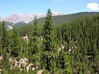
Photo from wikipedia
ABSTRACT The Sentinel-1 satellites provide the formerly unprecedented combination of high spatial and temporal resolution of dual polarization synthetic aperture radar data. The availability of dense time series enables the… Click to show full abstract
ABSTRACT The Sentinel-1 satellites provide the formerly unprecedented combination of high spatial and temporal resolution of dual polarization synthetic aperture radar data. The availability of dense time series enables the derivation and analysis of temporally filtered annual backscatter signals. The study concentrates on the use of Sentinel-1 seasonal backscatter signatures for forest area estimation and forest type classification. A classification method based on time series similarity measures is introduced and tested in three test areas covered by various forest types including broadleaf temperate, boreal and montane forests. The results are compared with two European-wide Copernicus high resolution layers, namely forest type and tree cover density (TCD). The correspondence of forest/non-forest maps and TCD is high in all test areas, with overall accuracies for forest/non-forest classification between 86% and 91% and Pearson correlation coefficients for TCD between 0.68 and 0.74. The forest type classification (non-forest, coniferous and broadleaf forest classes) provides best results in temperate forests with an overall accuracy of 85%; in boreal forest, the accuracy decreases to only 65%. Generally, the method provides reliable results for forest area estimation, including regions where methods based on static parameters are often problematic (mountainous areas), and it enables forest type classification in temperate forests.
Journal Title: International Journal of Remote Sensing
Year Published: 2018
Link to full text (if available)
Share on Social Media: Sign Up to like & get
recommendations!