Photo from wikipedia
AbstractHorizontal movement of pelagic fish predator, Yellowfin tuna (Thunnus albacares) has been decoded from Pop-up Satellite Archival Tags (PSAT) in Bay of Bengal. Environmental satellite data were matched with the… Click to show full abstract
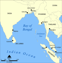
AbstractHorizontal movement of pelagic fish predator, Yellowfin tuna (Thunnus albacares) has been decoded from Pop-up Satellite Archival Tags (PSAT) in Bay of Bengal. Environmental satellite data were matched with the tag locations to understand and characterize the habitats of Yellowfin tuna (YFT). The tagging operation was performed in February 2013 and subsequently tracked for three months. A subset of tag data was selected corresponding to the maximum residence time of YFT indicated by high density data points. Different environmental factors viz. Sea Surface Temperature (SST), Sea Surface Height Anomaly (SSHa) and chlorophyll were retrieved from satellite. The tagged YFT spent 60 to 70% of time within waters of SST range 28–29.5°C and SSHa range +5-+12 cm. Time-series imageries of SSHa revealed a pair of warm-core and cold-core eddies at the site of YFT release and in vicinity. The tagged tuna repeatedly re-visited warm core and cold core eddies, which were up to 60 km apart. Satellite retrieved SST ...
Journal Title: Marine Geodesy
Year Published: 2017
Link to full text (if available)
Share on Social Media: Sign Up to like & get
recommendations!