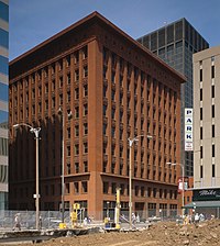
Photo from wikipedia
ABSTRACT The aim of this article is to investigate the relationship between urban form and knowledge–based economies through an example of how the spatial ordering of London’s 19th–century and early… Click to show full abstract
ABSTRACT The aim of this article is to investigate the relationship between urban form and knowledge–based economies through an example of how the spatial ordering of London’s 19th–century and early 20th–century furniture industry took place. Archival research, quantitative measures of urban form, and geographic information system–based business analytics were combined to test this proposition in 2 areas of London: Shoreditch and Fitzrovia. We hypothesize that the contrast between the spatial structures of the 2 districts contributed to the divergent path development of the furniture industry in these places. Analysis of the social networking of firms is performed and their spatial implications are assessed to determine what kinds of knowledge economies developed over time. In addition, qualitative data, captured through business invoices, are assessed, highlighting the implications on urban policy. This article contributes to the current debate within the field on the opportunities of integrating spatial networks and their use in policy.
Journal Title: Journal of Urban Affairs
Year Published: 2019
Link to full text (if available)
Share on Social Media: Sign Up to like & get
recommendations!