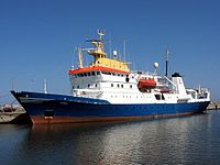
Photo from wikipedia
Abstract This study aims to illustrate how remotely sensed oceanic variables and fishing operations data can be used to predict suitable habitat of fishery resources in Geographic Information System. We… Click to show full abstract
Abstract This study aims to illustrate how remotely sensed oceanic variables and fishing operations data can be used to predict suitable habitat of fishery resources in Geographic Information System. We used sea surface height anomaly (SSHa), sea surface temperature (SST), chlorophyll concentration (CC), photosynthetically active radiation (PAR) and fishing depth as predictor variables. Fishery data of Indian squid (Loligo spp.) and catfish (Tachysurus spp.) for study period (1998–2004) were segregated randomly to create training and validation. Catch was normalized into Catch per unit Effort (kg h−1). Generalized additive modelling was performed on training data and then tested on validation data. Suitable ranges of SST, CC, SSHa and PAR for different species distributions were derived and integrated to predict their spatial distributions. Results indicated good match between predicted and actual catch. Monthly probability maps of predicted habitat areas coincide with high catch of the particular month for the study period.
Journal Title: Geocarto International
Year Published: 2017
Link to full text (if available)
Share on Social Media: Sign Up to like & get
recommendations!