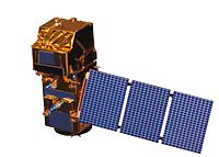
Photo from wikipedia
Abstract Atmospheric correction is used to remove atmospheric effects on remotely sensed imagery, so it could change its properties and, in the end, all the derived results from it. The… Click to show full abstract
Abstract Atmospheric correction is used to remove atmospheric effects on remotely sensed imagery, so it could change its properties and, in the end, all the derived results from it. The objective of this research was to analyse the effect of different atmospheric corrections on radiometric indices using Landsat 8 and Sentinel-2 satellite. Radiometric indices used in this research are Normalized difference vegetation index (NDVI), Normalized difference water index (NDWI), Soil-adjusted vegetation index (SAVI) and Modified soil-adjusted vegetation index (MSAVI). The analysis was done using five pairs of contemporary images from Landsat 8 and Sentinel-2. On the basis of those images, our results indicate that NDVI values between those two datasets did not have a statistically significant difference (p > 0.05) and have the strongest correlation for all used atmospheric corrections (r1 = 0.989, r2 = 0.967, r3 = 0.983). We concluded that it is possible to combine radiometric indices values from Landsat 8 and Sentinel-2 data.
Journal Title: Geocarto International
Year Published: 2019
Link to full text (if available)
Share on Social Media: Sign Up to like & get
recommendations!