Photo from wikipedia
ABSTRACT The traditional hill-shading map is usually produced from a digital elevation model (DEM) by using the method of hypsometric tinting, which is capable of demonstrating the changes in geomorphology… Click to show full abstract
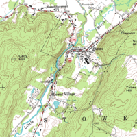
ABSTRACT The traditional hill-shading map is usually produced from a digital elevation model (DEM) by using the method of hypsometric tinting, which is capable of demonstrating the changes in geomorphology by setting the colors for hill-shading. However, the disadvantage is obvious that the surface features of the terrain can only be utilized by putting vector data on the map. Hence, the terrain display effect will be altered, especially in the production of large-scale maps, for which the artistic effect will be greatly weakened. This paper proposes a solution to this problem. First, we transform the RGB color space of the Digital orthophotographic map (DOM) image into the intensity-hue-saturation (IHS) color space. Then, we calculate the new value of the intensity as I′ for each pixel of the shaded relief model (SRM) of the high-resolution remote sensing image. Finally, we replace the component I with the new component I′ and then proceed with the inverse IHS transform. The case study shows that an objective representation of the actual situation is presented in the mapping area, and the 3D performance capabilities are enhanced. This research indicates that when the method of fusing the processed SRM with the IHS color system is used, the optimum index factor (OIF) and entropy of the generated map are 41.26 and 12.05, respectively, which are much greater than for the results of the traditional method. In other words, the proposed method can greatly enhance the terrain effect.
Journal Title: Annals of GIS
Year Published: 2021
Link to full text (if available)
Share on Social Media: Sign Up to like & get
recommendations!