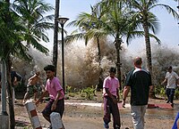
Photo from wikipedia
ABSTRACT On the 22nd of December 2018 the shorelines of Sunda Strait, Indonesia, were hit by tsunami waves generated by the flank collapse of the Anak Krakatau volcano. The authors… Click to show full abstract
ABSTRACT On the 22nd of December 2018 the shorelines of Sunda Strait, Indonesia, were hit by tsunami waves generated by the flank collapse of the Anak Krakatau volcano. The authors conducted a field survey of the affected areas in both Sumatra and Java islands to collect information on tsunami inundation and run-up heights, damage patterns at each coastal community, and the evacuation behaviour and tsunami awareness of the affected people. The survey results showed that in Sumatra island inundation heights of more than 4 m were measured along the coastline that was situated to the north-north-east of Anak Krakatau, while less than 4 m were measured along the north-western direction. Inundation heights of over 10 m were measured at Cipenyu Beach (Pandeglang Regency) in Java island (south-south-eastern direction from Anak Krakatau). A questionnaire survey conducted by the authors revealed residents’ perception of danger and evacuation patterns during the event. The results indicate the importance of having an operational tsunami warning system in Sunda Strait and the establishment of an appropriate evacuation plan so that residents can start evacuation immediately and reach a safe place without facing severe congestion along evacuation routes.
Journal Title: Coastal Engineering Journal
Year Published: 2019
Link to full text (if available)
Share on Social Media: Sign Up to like & get
recommendations!