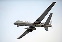
Photo from wikipedia
Unmanned aerial vehicles (UAVs) are increasingly used in marine wildlife research. As technological developments rapidly advance the versatility and functionality of affordable UAVs, their potential as a marine aerial survey… Click to show full abstract
Unmanned aerial vehicles (UAVs) are increasingly used in marine wildlife research. As technological developments rapidly advance the versatility and functionality of affordable UAVs, their potential as a marine aerial survey tool is quickly gaining attention. Currently, there is significant interest in whether cost-effective UAVs can outperform manned aircraft in aerial surveys of marine fauna at sea, although few empirical studies have compared relative sampling efficiency, accuracy and precision. Civil aviation restrictions, and subsequent available civilian technologies, make it unlikely that UAVs will currently be more effective than manned aircraft for large area marine surveys. UAVs do, however, have the capacity to fill a niche for intensive smaller spatial scale sampling and for undertaking aerial surveys in isolated locations. Improvements in UAV sensor resolutions and alternative sensor types, such as multispectral cameras, may increase area coverage, reduce perception error, and increase water penetration for sightability. Additionally, the further development of auto-detection software will rapidly improve image processing and further reduce human observer error inherent in manned aerial surveys. As UAV technologies and associated methodology is further developed and becomes more affordable, these aircraft will be increasingly adopted as a marine aerial survey tool in place of traditional methods using manned aircraft.
Journal Title: ICES Journal of Marine Science
Year Published: 2018
Link to full text (if available)
Share on Social Media: Sign Up to like & get
recommendations!