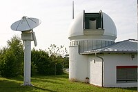
Photo from wikipedia
A proof-of-concept experiment has demonstrated that wideband (400 MHz) signals of opportunity (SoOp) transmitted in K- and Ku-bands from geostationary satellites can be used for coastal altimetry. An essential finding… Click to show full abstract
A proof-of-concept experiment has demonstrated that wideband (400 MHz) signals of opportunity (SoOp) transmitted in K- and Ku-bands from geostationary satellites can be used for coastal altimetry. An essential finding from this experiment is that the full broadcast spectrum consisting of multiple digital channels can be processed as a single wideband signal source. An established error model for Global Navigation Satellite System interferometric altimetry was shown to accurately represent the sea surface height (SSH) retrievals when evaluated using the full bandwidth. This experiment was conducted over a 72-h period at Platform Harvest off the Pacific Coast. Colocated tide gauge and LiDAR measurements were used as in situ data. Two anomalies were observed in the experiment: 1) multiple peaks in the cross correlation waveform from one polarization of Ku-band frequency and 2) decrease in signal-to-noise ratio from loss of a data channel. When the instances of multiple peaks were eliminated and the equivalent bandwidth recomputed using only the active channels, SSH error from these cases agreed well with the model prediction. Application of SoOp wideband altimetry will, therefore, require a monitoring capability to identify changes in the transmission spectrum, total power, and waveform shape, for quality control and setting an appropriate observation error covariance. Measurement precision from a satellite receiver is predicted to be between 4 and 6 cm using the error model. SoOp altimetry with these signals may improve coastal measurements and increase the sampling and revisit rate through the use of a constellation of small satellites.
Journal Title: IEEE Geoscience and Remote Sensing Letters
Year Published: 2019
Link to full text (if available)
Share on Social Media: Sign Up to like & get
recommendations!