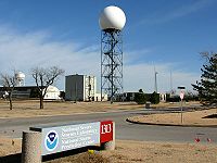
Photo from wikipedia
The National Weather Service has initiated an effort to upgrade the scan strategy of the operational Weather Surveillance Radar-1988 Doppler (WSR-88D) to improve its hydrometeorological applications. The lowest scan elevation… Click to show full abstract
The National Weather Service has initiated an effort to upgrade the scan strategy of the operational Weather Surveillance Radar-1988 Doppler (WSR-88D) to improve its hydrometeorological applications. The lowest scan elevation angle has been changed from 0.5° to 0° (or even lower in the future) for some WSR-88D stations. Using the KMUX WSR-88D radar deployed in mountainous terrain in Northern California as an example, this letter quantifies the impacts of lowering the minimum scan elevation angle of WSR-88D radar on surface rainfall mapping, with an emphasis on shallow orographic precipitation. In order to estimate surface rainfall using radar observations, polarimetric radar rainfall relations are established using local disdrometer data, which are then implemented with the KMUX radar observations at 0° and 0.5° scan elevation angles to derive rainfall estimates. Comparative evaluation of the radar-based rainfall estimates using rainfall measurements from surface rain gauges has demonstrated the superior performance of the lower scan elevation angle. When the distance from the radar is long (i.e., when the radar beam is likely within or above the melting layer), the improvement gained by the 0° scan relative to the 0.5° scan is 16.1% and 19.5% in terms of the normalized standard error (NSE) and the Pearson correlation coefficient (CORR), respectively.
Journal Title: IEEE Geoscience and Remote Sensing Letters
Year Published: 2023
Link to full text (if available)
Share on Social Media: Sign Up to like & get
recommendations!