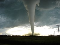
Photo from wikipedia
On average, modern numerical weather prediction forecasts for daily tornado frequency exhibit no skill beyond day 10. However, in this extended-range lead window, there are particular model cycles that have… Click to show full abstract
On average, modern numerical weather prediction forecasts for daily tornado frequency exhibit no skill beyond day 10. However, in this extended-range lead window, there are particular model cycles that have exceptionally high forecast skill for tornadoes owing to their ability to correctly simulate the future synoptic pattern. Here, model initial conditions that produced a more skillful forecast for tornadoes over the U.S. were exploited, while also highlighting potential causes for low-skill cycles within the Global Ensemble Forecasting System, version 12 (GEFSv12). Eighty-eight high-skill and 91 low-skill forecasts in which the verifying day-10 synoptic pattern for tornado conditions revealed a western U.S. thermal trough and an eastern U.S. thermal ridge, a favorable configuration for tornadic storm occurrence. Initial conditions for high skill forecasts tended to exhibit warmer sea-surface temperatures throughout the tropical Pacific Ocean and Gulf of Mexico, an active Madden-Julian Oscillation, and significant modulation of Earth-relative atmospheric angular momentum. Low-skill forecasts were often initialized during La Niña and negative Pacific Decadal Oscillation conditions. Significant atmospheric blocking over eastern Russia—in which the GEFSv12 over forecasted the duration and characteristics of the downstream flow—was a common physical process associated with low-skill forecasts. This work helps to increase our understanding of the common causes of high- or low-skill extended-range tornado forecasts and could serve as a helpful tool for operational forecasters.
Journal Title: Weather and Forecasting
Year Published: 2023
Link to full text (if available)
Share on Social Media: Sign Up to like & get
recommendations!