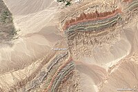
Photo from wikipedia
The Wabash Valley seismic zone (WVSZ) is a region of diffuse, modern intraplate seismicity in the central United States with a history of strong, late Quaternary and Holocene seismicity as… Click to show full abstract
The Wabash Valley seismic zone (WVSZ) is a region of diffuse, modern intraplate seismicity in the central United States with a history of strong, late Quaternary and Holocene seismicity as determined through paleoliquefaction studies. Yet, there are no specific faults linked to these strong WVSZ paleoearthquakes, some of which were as large as Mw 7.2–7.5. A multidisciplinary investigation of a linear, 5-kilometer-long and ∼3-meter-high scarp on the Ohio River floodplain in the southernmost WVSZ in western Kentucky evaluated whether the scarp is a fluvial landform or a tectonic feature. Geomorphic mapping and optically stimulated luminescence geochronology show that the age and orientation of the scarp are inconsistent with surrounding fluvial landforms. Trenching, core drilling, seismic reflection, electrical resistivity profiling, and cross sections of petroleum well logs all indicate a blind fault directly underlies the scarp. The scarp is interpreted to be the fold axis of a down-to-the-west monocline formed in alluvium by slip on the underlying blind fault, herein named the Uniontown fault. The Uniontown fault connects the Hovey Lake fault, striking N20°E and having ∼0.5 km of documented strike-slip offset, with an unnamed fault complex to the south that strikes N40°E, suggesting the Uniontown fault is part of a larger, Paleozoic structure that has been reactivated with strike-slip deformation. Geomorphic mapping utilizing luminescence and radiocarbon geochronology indicates that folding and faulting occurred ∼3.5 ka. Paleoliquefaction was suppressed by a thick clay cap in the main Ohio Valley, but paleoliquefaction features are widespread on Ohio River tributaries. Gravel dikes at one site had a maximum age of 3.4±0.4 ka, confirming the region has experienced strong, late Holocene shaking. Estimates using vertical displacement and rupture length indicate that slip on the Uniontown scarp could produce an Mw 6.2–7.7 earthquake, which is comparable to other large paleoearthquakes in the WVSZ paleoseismic record.
Journal Title: Bulletin of the Seismological Society of America
Year Published: 2021
Link to full text (if available)
Share on Social Media: Sign Up to like & get
recommendations!