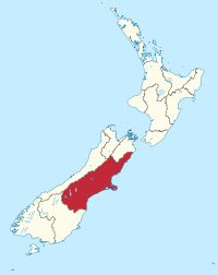
Photo from wikipedia
This article presents modified Mercalli intensity (MMI) data for the 22 February 2011 Mw 6.2 Christchurch, New Zealand, earthquake. These data include intensity levels above MMI 8 that have not been… Click to show full abstract
This article presents modified Mercalli intensity (MMI) data for the 22 February 2011 Mw 6.2 Christchurch, New Zealand, earthquake. These data include intensity levels above MMI 8 that have not been assigned previously. Two sources of data have been used in this research: GeoNet’s “Felt Classic” online questionnaires and felt reports gathered during a field study in Christchurch in February 2013. Taken together, these sets of data provided 331 valid (i.e., with all the needed information) felt reports in areas of MMI 8 or above, with 299 (90%) of the reports used to assign MMI levels above 8. This article presents a more detailed picture of the geographical damage distribution of this earthquake than has previously been available. The data differentiate damage in the center of Christchurch, with 8 communities assigned a community MMI (CMMI) of 9, 11 communities a CMMI of 10, and 8 communities a CMMI of 11, which is the maximum possible intensity in the New Zealand MMI scale, and a level of intensity not previously reported in New Zealand (Dowrick et al., 2008). The geographical damage distribution for Christchurch has been updated for intensities below MMI 8. This was done using a recently developed method that groups intensity data and allows intensities to be aggregated for a community and a single value assigned. Comparisons between MMI and peak ground velocity using the CMMI data and two ground-motion intensity correlation equations (GMICEs) indicate an underestimation of MMI when using the GMICEs and the need to review New Zealand’s GMICE.
Journal Title: Seismological Research Letters
Year Published: 2019
Link to full text (if available)
Share on Social Media: Sign Up to like & get
recommendations!