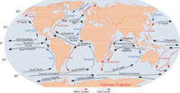
Photo from wikipedia
The western Indian Ocean (WIO) along the East African coast, popularly known as the Swahili coast, stretches between lat 15°48′0′′N and 14°53′5′′N and long 74°20′1′′E and 73°40′3′′E. The Swahili coast… Click to show full abstract
The western Indian Ocean (WIO) along the East African coast, popularly known as the Swahili coast, stretches between lat 15°48′0′′N and 14°53′5′′N and long 74°20′1′′E and 73°40′3′′E. The Swahili coast extends 3000 km from Somalia to the north through Kenya and Tanzania to Mozambique in the south. It also includes island states of Comoro, Seychelles, Madagascar, Reunion and Mauritius. The characteristics of the coastal areas of continental countries and Madagascar are similar: alternating beaches, rocky outcrops, coral reefs, large estuarine areas, wetlands, lagoons and inter-tidal fiats. The coastline consists of reefs, lagoons, beaches, rivers, creeks and low-lying coastal plains. For hundreds of years, by using different types of water crafts, maritime traders have sailed the Indian Ocean, governed by adequate knowledge of regular and predictable monsoon winds blowing between the Indian subcontinent and Africa. The east African coast occupies a significant place in the maritime activity and trade contacts with the external world in the Indian Ocean.
Journal Title: Current Science
Year Published: 2019
Link to full text (if available)
Share on Social Media: Sign Up to like & get
recommendations!