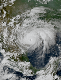
Photo from wikipedia
Objectives. To compare the flood impacts experienced by Harris County, Texas, hospitals with Federal Emergency Management Agency (FEMA) flood hazard areas and Hurricane Harvey's inundation boundary.Methods. One year following Hurricane… Click to show full abstract
Objectives. To compare the flood impacts experienced by Harris County, Texas, hospitals with Federal Emergency Management Agency (FEMA) flood hazard areas and Hurricane Harvey's inundation boundary.Methods. One year following Hurricane Harvey, we created a novel data set of Hurricane Harvey's flood impacts in Harris County hospitals. We then mapped the hospital flood impact data in ArcGIS alongside FEMA flood hazard areas and Hurricane Harvey's inundation boundary to classify each hospital's location in high flood-risk areas and in areas purportedly affected by Hurricane Harvey.Results. Of the 66 hospitals for which flood impact information was ascertained, 16 (24%) hospitals experienced flood impacts during Hurricane Harvey. Of these 16 hospitals, 5 (31%) were located outside a FEMA flood hazard area and 8 (50%) were located outside Hurricane Harvey's inundation boundary.Conclusions. FEMA flood hazard areas did not accurately predict all areas of Harris County, Texas, that flooded during Hurricane Harvey or which hospitals experienced flood impacts. (Am J Public Health. Published online ahead of print February 20, 2020: e1-e6. doi:10.2105/AJPH.2019.305520).
Journal Title: American journal of public health
Year Published: 2020
Link to full text (if available)
Share on Social Media: Sign Up to like & get
recommendations!