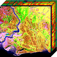
Photo from wikipedia
In this paper, we build a remote-sensing satellite imagery priori-information data set, and propose an approach to evaluate the robustness of remote-sensing image feature detectors. The building TH Priori-Information (TPI)… Click to show full abstract
In this paper, we build a remote-sensing satellite imagery priori-information data set, and propose an approach to evaluate the robustness of remote-sensing image feature detectors. The building TH Priori-Information (TPI) data set with 2297 remote sensing images serves as a standardized high-resolution data set for studies related to remote-sensing image features. The TPI contains 1) raw and calibrated remote-sensing images with high spatial and temporal resolutions (up to 2 m and 7 days, respectively), and 2) a built-in 3-D target area model that supports view position, view angle, lighting, shadowing, and other transformations. Based on TPI, we further present a quantized approach, including the feature recurrence rate, the feature match score, and the weighted feature robustness score, to evaluate the robustness of remote-sensing image feature detectors. The quantized approach gives general and objective assessments of the robustness of feature detectors under complex remote-sensing circumstances. Three remote-sensing image feature detectors, including scale-invariant feature transform (SIFT), speeded up robust features (SURF), and priori information based robust features (PIRF), are evaluated using the proposed approach on the TPI data set. Experimental results show that the robustness of PIRF outperforms others by over 6.2%.
Journal Title: China Communications
Year Published: 2020
Link to full text (if available)
Share on Social Media: Sign Up to like & get
recommendations!