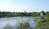
Photo from wikipedia
There are various clay belts within the Canadian Shield which represent the beds of Pleistocene lakes. The soils and terrain are more suitable to agricultural use than the surrounding shield.… Click to show full abstract
There are various clay belts within the Canadian Shield which represent the beds of Pleistocene lakes. The soils and terrain are more suitable to agricultural use than the surrounding shield. The best known of these clay belts lies along the 49th parallel for over 800 km in the Canadian provinces of Ontario and Quebec. The Clay Belt area in northeastern Ontario consists of 10.2 million acres of land, 35% of which is covered in coniferous forest and 28% in mixed forest. The Clay Belt of northeastern Ontario has experienced agricultural growth followed by dramatic decline marked by occasional small reversals; agricultural land in the area peaked in 1951 since which time it has steadily declined although there are recent indications of renewed interest in the abundance of viable agricultural land in the region with the provincial government and agricultural groups in Ontario actively promoting related opportunities. Evolutionary economic geography’s emphasis on the significance of history and geography in understanding the development of spatial economies can be applied to the region to better understand how the processes of path creation and path dependence have interacted to shape the geographies of agricultural development in the region. This region has the potential to contribute significantly to agricultural development, food production and in turn benefit local rural economies. The trajectory of agricultural development, however, tells a story of economic, social and environmental barriers that affect sustainability and related environmental impact. This paper will consider the opportunities for agricultural development, while recognizing the need for policy that is sensitive to community needs.
Journal Title: Emerging Infectious Diseases
Year Published: 2020
Link to full text (if available)
Share on Social Media: Sign Up to like & get
recommendations!