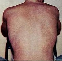
Photo from wikipedia
Dengue fever is an acute mosquito-borne disease that mostly spreads within urban or semi-urban areas in warm climate zones. The dengue-related risk map is one of the most practical tools… Click to show full abstract
Dengue fever is an acute mosquito-borne disease that mostly spreads within urban or semi-urban areas in warm climate zones. The dengue-related risk map is one of the most practical tools for executing effective control policies, breaking the transmission chain, and preventing disease outbreaks. Mapping risk at a small scale, such as at an urban level, can demonstrate the spatial heterogeneities in complicated built environments. This review aims to summarize state-of-the-art modeling methods and influential factors in mapping dengue fever risk in urban settings. Data were manually extracted from five major academic search databases following a set of querying and selection criteria, and a total of 28 studies were analyzed. Twenty of the selected papers investigated the spatial pattern of dengue risk by epidemic data, whereas the remaining eight papers developed an entomological risk map as a proxy for potential dengue burden in cities or agglomerated urban regions. The key findings included: (1) Big data sources and emerging data-mining techniques are innovatively employed for detecting hot spots of dengue-related burden in the urban context; (2) Bayesian approaches and machine learning algorithms have become more popular as spatial modeling tools for predicting the distribution of dengue incidence and mosquito presence; (3) Climatic and built environmental variables are the most common factors in making predictions, though the effects of these factors vary with the mosquito species; (4) Socio-economic data may be a better representation of the huge heterogeneity of risk or vulnerability spatial distribution on an urban scale. In conclusion, for spatially assessing dengue-related risk in an urban context, data availability and the purpose for mapping determine the analytical approaches and modeling methods used. To enhance the reliabilities of predictive models, sufficient data about dengue serotyping, socio-economic status, and spatial connectivity may be more important for mapping dengue-related risk in urban settings for future studies.
Journal Title: International Journal of Environmental Research and Public Health
Year Published: 2022
Link to full text (if available)
Share on Social Media: Sign Up to like & get
recommendations!