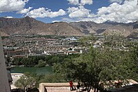
Photo from wikipedia
Abstract. Critical gaps in the amount, quality, consistency, availability, and spatial distribution of rainfall data limit extreme precipitation analysis, and the application of gridded precipitation data are challenging because of… Click to show full abstract
Abstract. Critical gaps in the amount, quality, consistency, availability, and spatial distribution of rainfall data limit extreme precipitation analysis, and the application of gridded precipitation data are challenging because of their considerable biases. This study corrected Asian Precipitation Highly Resolved Observational Data Integration Towards Evaluation of Water Resources (APHRODITE) in the Yarlung Tsangpo-Brahmaputra River Basin (YBRB) using two linear and two nonlinear methods, and assessed their influence on extreme precipitation indices. The results showed that the original APHRODITE data tended to underestimate precipitation during the summer monsoon season, especially in the topographically complex Himalayan belt. Bias correction using complementary rainfall observations to add spatial coverage in data-sparse regions greatly improved the performance of extreme precipitation analysis. Although all methods could correct mean precipitation, their ability to correct the wet-day frequency and coefficient of variation were substantially different, leading to considerable differences in extreme precipitation indices. Generally, higher-skill bias-corrected APHRODITE data are expected to perform better than those corrected by lower-skill approaches. This study would provide reference for using gridded precipitation data in extreme precipitation analysis and selecting bias-corrected method for rainfall products in data-sparse regions.
Journal Title: Natural Hazards and Earth System Sciences
Year Published: 2019
Link to full text (if available)
Share on Social Media: Sign Up to like & get
recommendations!