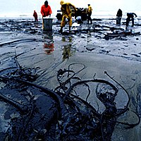
Impacts of Oil Spills on Altimeter Waveforms and Radar Backscatter Cross Section
Sign Up to like & getrecommendations! Published in 2017 at "Journal of Geophysical Research"
DOI: 10.1002/2016jc012568
Abstract: Ocean surface films can damp short capillary-gravity waves, reduce the surface mean square slope, and induce “sigma0 blooms” in satellite altimeter data. No study has ascertained the effect of such film on altimeter measurements due… read more here.
Keywords: wind; oil spill; impacts oil; altimeter data ... See more keywords

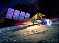
Nonparametric estimations of the sea state bias for a radar altimeter
Sign Up to like & getrecommendations! Published in 2017 at "Acta Oceanologica Sinica"
DOI: 10.1007/s13131-017-1116-x
Abstract: To estimate the sea state bias (SSB) for radar altimeter, two nonparametric models, including a Nadaraya-Watson (NW) kernel estimator and a local linear regression (LLR) estimator, are studied based on the Jason-2 altimeter data. Selecting… read more here.
Keywords: state bias; sea state; radar altimeter; altimeter ... See more keywords

Detection of iceberg using Delay Doppler and interferometric Cryosat-2 altimeter data
Sign Up to like & getrecommendations! Published in 2018 at "Remote Sensing of Environment"
DOI: 10.1016/j.rse.2018.04.037
Abstract: Abstract The Cryosat-2 Synthetic Aperture Interferometric Radar Altimeter (SIRAL) altimeter is the first altimeter that can operate in three different modes over the ocean: the classical pulse limited LRM, the Delay Doppler or SAR and… read more here.
Keywords: detection iceberg; delay doppler; altimeter;

Synergic use of altimeter and model sea level data in inner and coastal seas
Sign Up to like & getrecommendations! Published in 2021 at "Remote Sensing of Environment"
DOI: 10.1016/j.rse.2021.112500
Abstract: Abstract We analyse high rate (20 Hz) altimeter derived sea level information, both from Synthetic Aperture Radar (SAR) altimetry missions and Low Resolution Mode missions, in an inner sea and coastal environment. They are compared versus… read more here.
Keywords: sea level; synergic use; altimeter; model ... See more keywords

In-Orbit Calibration and Validation of HY-2B Altimeter Using an Improved Transponder
Sign Up to like & getrecommendations! Published in 2021 at "IEEE Journal of Selected Topics in Applied Earth Observations and Remote Sensing"
DOI: 10.1109/jstars.2021.3111922
Abstract: HY-2B (Haiyang) is the follow-on mission to HY-2A, the Chinese first sea satellite for oceanography, launched in October 2018. The main payloads onboard are similar to HY-2A. For the altimeter, an in-orbit calibration mode was… read more here.
Keywords: improved transponder; calibration; orbit calibration; altimeter ... See more keywords

Sea Surface Wind Retrieval Using the Combined Scatterometer and Altimeter Backscatter Measurements of the HY-2B Satellite
Sign Up to like & getrecommendations! Published in 2022 at "IEEE Transactions on Geoscience and Remote Sensing"
DOI: 10.1109/tgrs.2021.3065663
Abstract: Sea surface winds derived from the spaceborne rotating pencil-beam scatterometers, such as the current Chinese Haiyang-2 (HY-2) scatterometers and the Indian SCATSAT-1 scatterometer, are used in a wide range of atmospheric and oceanic applications. One… read more here.
Keywords: inversion; combined scatterometer; scatterometer; surface ... See more keywords

Evaluation of Coastal Altimeter Wave Height Observations Using Dynamic Collocation
Sign Up to like & getrecommendations! Published in 2022 at "IEEE Transactions on Geoscience and Remote Sensing"
DOI: 10.1109/tgrs.2022.3198430
Abstract: With the development of altimeters’ retracking algorithms, the signal-to-noise ratio of altimeter data in coastal regions has been improved significantly in recent years. However, due to the complexity of coastal waves, the traditional satellite-buoy/satellite-satellite collocation… read more here.
Keywords: evaluation; coastal altimeter; collocation; wave height ... See more keywords

An Electromagnetic Simulator for Sentinel-3 SAR Altimeter Waveforms Over Land—Part I: Bare Soil
Sign Up to like & getrecommendations! Published in 2022 at "IEEE Transactions on Geoscience and Remote Sensing"
DOI: 10.1109/tgrs.2022.3210720
Abstract: ALtimetry for BIOMass (ALBIOM) is a Permanent Open Call Project funded by the European Space Agency (ESA) to explore the possibility of forest biomass retrieval by using Copernicus Sentinel-3 (S-3) Synthetic aperture Radar ALtimeter (SRAL)… read more here.
Keywords: electromagnetic simulator; simulator; bare soil; topography ... See more keywords

An Electromagnetic Simulator for Sentinel-3 SAR Altimeter Waveforms Over Land—Part II: Forests
Sign Up to like & getrecommendations! Published in 2022 at "IEEE Transactions on Geoscience and Remote Sensing"
DOI: 10.1109/tgrs.2022.3210722
Abstract: Forests play a crucial role in the climate change mitigation by acting as sinks for carbon and, consequently, reducing the CO2 concentration in the atmosphere and slowing global warming. For this reason, above ground biomass… read more here.
Keywords: electromagnetic simulator; sentinel sar; simulator; vegetation ... See more keywords

Impact of Multiple Altimeter Data and Mean Dynamic Topography in a Global Analysis and Forecasting System
Sign Up to like & getrecommendations! Published in 2019 at "Journal of Atmospheric and Oceanic Technology"
DOI: 10.1175/jtech-d-18-0236.1
Abstract: Satellite altimetry is one of the main sources of information used to constrain global ocean analysis and forecasting systems. In addition to in situ vertical temperature and salinity profiles and sea surface temperature (SST) data,… read more here.
Keywords: system; topography; analysis forecasting; dynamic topography ... See more keywords

Altimeter Observations of Tropical Cyclone-generated Sea States: Spatial Analysis and Operational Hindcast Evaluation
Sign Up to like & getrecommendations! Published in 2021 at "Journal of Marine Science and Engineering"
DOI: 10.3390/jmse9020216
Abstract: Tropical cyclones (TC) are some of the most intense weather systems on Earth and are responsible for generating hazardous waves on the sea surface that dominate the extreme wave climate in several regions, including the… read more here.
Keywords: altimeter; altimeter observations; cyclone generated; observations tropical ... See more keywords