
Exploring an integrated spatially model for land-use scenarios simulation in a metropolitan region
Sign Up to like & getrecommendations! Published in 2021 at "Environment, Development and Sustainability"
DOI: 10.1007/s10668-021-01231-4
Abstract: Spatial simulation of land-use change scenarios in metropolitan areas is essential for analyzing both the causes and consequences of various future scenarios and is also valuable for land-use planning and management. However, current simulation models… read more here.
Keywords: use; use changes; simulation; built areas ... See more keywords
Extraction and Evolution Analysis of Urban Built-Up Areas in Beijing, 1984–2018
Sign Up to like & getrecommendations! Published in 2021 at "Applied Spatial Analysis and Policy"
DOI: 10.1007/s12061-021-09374-7
Abstract: Accurate extraction of the boundaries of urban built-up areas (UBA) based on remote sensing and GIS technology is extremely important for predicting urban spatial evolution. Therefore, this study proposes a method for extracting urban built-up… read more here.
Keywords: areas beijing; built areas; urban built; extraction ... See more keywords

Automated Extraction of Slum Built-up Areas from Multispectral Imageries
Sign Up to like & getrecommendations! Published in 2019 at "Journal of the Indian Society of Remote Sensing"
DOI: 10.1007/s12524-019-01066-7
Abstract: Slum areas are dense urban areas in which the building size is quite small, and the buildings are interconnected with each other. Also, there is a lot of variation in the texture of slum area… read more here.
Keywords: methodology; extraction; area; built areas ... See more keywords

Evaluating urban vegetation scenarios to mitigate urban heat island and reduce buildings' energy in dense built-up areas in Cairo
Sign Up to like & getrecommendations! Published in 2019 at "Building and Environment"
DOI: 10.1016/j.buildenv.2019.106407
Abstract: Abstract Cairo is characterized by high temperature compared to its surrounding areas, especially during the summer time. This effect is strengthened by the widespread use of sealed surfaces and the lack of vegetation. Therefore, the… read more here.
Keywords: dense built; energy; urban heat; heat island ... See more keywords
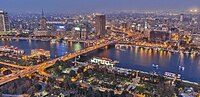
Evaluating the effect of trees on UHI mitigation and reduction of energy usage in different built up areas in Cairo
Sign Up to like & getrecommendations! Published in 2020 at "Building and Environment"
DOI: 10.1016/j.buildenv.2019.106490
Abstract: Abstract Cairo experiences higher temperatures than its neighbouring rural and suburban areas. This is due to the lack of vegetation and the wide scale use of sealed surfaces. This phenomenon is known as Urban Heat… read more here.
Keywords: effect trees; energy; areas cairo; density ... See more keywords

WE-NDBI-A new index for mapping urban built-up areas from GF-1 WFV images
Sign Up to like & getrecommendations! Published in 2020 at "Remote Sensing Letters"
DOI: 10.1080/2150704x.2020.1723171
Abstract: ABSTRACT Recently, China has witnessed rapid development of high-resolution imaging satellites, with remote sensing images from satellites being applied extensively in social and economic sectors. The normalized difference built-up index (NDBI) was first used to… read more here.
Keywords: built areas; mapping urban; urban built; approach ... See more keywords

Deep Learning-Based Classification Methods for Remote Sensing Images in Urban Built-Up Areas
Sign Up to like & getrecommendations! Published in 2019 at "IEEE Access"
DOI: 10.1109/access.2019.2903127
Abstract: Urban areas have been focused recently on the remote sensing applications since their function closely relates to the distribution of built-up areas, where reflectivity or scattering characteristics are the same or similar. Traditional pixel-based methods… read more here.
Keywords: remote sensing; learning based; built areas; urban built ... See more keywords

Leveraging ALOS-2 PALSAR-2 for Mapping Built-Up Areas and Assessing Their Vertical Component
Sign Up to like & getrecommendations! Published in 2020 at "IEEE Journal of Selected Topics in Applied Earth Observations and Remote Sensing"
DOI: 10.1109/jstars.2020.3036345
Abstract: Built-up areas extraction and characterization from remote sensing images is essential for monitoring urbanization and the associated challenges. This work presents a novel integrated classification framework building on the symbolic machine learning classifier and fully… read more here.
Keywords: alos palsar; remote sensing; built areas; leveraging alos ... See more keywords

A Novel Technique for Inversion of Rotation Angles in Built-Up Areas
Sign Up to like & getrecommendations! Published in 2022 at "IEEE Geoscience and Remote Sensing Letters"
DOI: 10.1109/lgrs.2021.3088126
Abstract: In previous publications, it is generally believed that the rotated buildings in built-up areas can induce polarization orientation angles, which cause overestimation of the volume scattering contribution. However, we found that the rotation effect of… read more here.
Keywords: built areas; rotation; novel technique; technique inversion ... See more keywords

Empirical approach to threshold determination for the delineation of built-up areas with road network data
Sign Up to like & getrecommendations! Published in 2018 at "PLoS ONE"
DOI: 10.1371/journal.pone.0194806
Abstract: Various approaches have been proposed to address the delineation of built-up areas for a wide range of applications. Recently developed approaches are based on the increasing availability of road network data. However, most approaches have… read more here.
Keywords: built areas; delineation built; network data; road network ... See more keywords

Spatial Expansion of Built-Up Areas in the Beijing–Tianjin–Hebei Urban Agglomeration Based on Nighttime Light Data: 1992–2020
Sign Up to like & getrecommendations! Published in 2022 at "International Journal of Environmental Research and Public Health"
DOI: 10.3390/ijerph19073760
Abstract: Built-up areas are one of the most intuitive and important indicators used to assess urbanization, the spatial expansion of which is of great significance in depicting the evolution of urban spatial structures. Based on the… read more here.
Keywords: urban agglomeration; hebei urban; built areas; tianjin hebei ... See more keywords