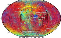
The 3-D geological model around Chang'E-3 landing site based on lunar penetrating radar Channel 1 data
Sign Up to like & getrecommendations! Published in 2017 at "Geophysical Research Letters"
DOI: 10.1002/2017gl073589
Abstract: High-frequency lunar penetrating radar (LPR) data from an instrument on the lunar rover Yutu, from the Chang'E-3 (CE-3) robotic lander, were used to build a three-dimensional (3-D) geological model of the lunar subsurface structure. The… read more here.
Keywords: penetrating radar; lunar penetrating; chang; geological model ... See more keywords

A Pre-Landing Assessment of Regolith Properties at the InSight Landing Site
Sign Up to like & getrecommendations! Published in 2018 at "Space Science Reviews"
DOI: 10.1007/s11214-018-0537-y
Abstract: This article discusses relevant physical properties of the regolith at the Mars InSight landing site as understood prior to landing of the spacecraft. InSight will land in the northern lowland plains of Mars, close to… read more here.
Keywords: insight landing; physical properties; properties include; regolith ... See more keywords

Mineralogy of Chang’e-4 landing site: preliminary results of visible and near-infrared imaging spectrometer
Sign Up to like & getrecommendations! Published in 2020 at "Science China Information Sciences"
DOI: 10.1007/s11432-019-2768-1
Abstract: The exploration of mafic anomaly in South Pole-Aitken (SPA, the largest confirmed) basin on the Moon provides important insights into lunar interior. The landing of Chang’e-4 (CE-4) and deployment of Yutu-2 rover on the discontinuous… read more here.
Keywords: mineralogy; visible near; near infrared; infrared imaging ... See more keywords
Landing site topographic mapping and rover localization for Chang’e-4 mission
Sign Up to like & getrecommendations! Published in 2020 at "Science China Information Sciences"
DOI: 10.1007/s11432-019-2796-1
Abstract: This paper presents the techniques and results of landing-site topographic mapping and rover localization using orbital, descent and rover images in the Chang’e-4 mission. High-resolution maps of the landing site are generated from orbital and… read more here.
Keywords: site topographic; rover; mission; site ... See more keywords

Identification of landing sites for rescue helicopters in mountains with use of Geographic Information Systems
Sign Up to like & getrecommendations! Published in 2020 at "Journal of Mountain Science"
DOI: 10.1007/s11629-019-5805-0
Abstract: Helicopters are often used in mountain rescue both for rescuers moving in the area of accidents and for evacuating victims, but in steep or forested terrain finding a landing place can be problematic. The main… read more here.
Keywords: identification landing; landing site; rescue helicopters; landing sites ... See more keywords

Southern Meridiani Planum - A candidate landing site for the first crewed mission to Mars
Sign Up to like & getrecommendations! Published in 2017 at "Acta Astronautica"
DOI: 10.1016/j.actaastro.2016.12.039
Abstract: Abstract Astronauts working on the surface of Mars have the capability to explore efficiently, rapidly, and flexibly, allowing them to perform a wide range of field investigations. NASA has begun an open international process to… read more here.
Keywords: first crewed; candidate; southern meridiani; mission ... See more keywords

Composition, mineralogy and chronology of mare basalts and non-mare materials in Von Kármán crater: Landing site of the Chang’E−4 mission
Sign Up to like & getrecommendations! Published in 2019 at "Planetary and Space Science"
DOI: 10.1016/j.pss.2019.104741
Abstract: Abstract As the first lunar farside landed mission, China’s Chang’E−4 (CE-4) has safely landed on the volcanically resurfaced floor of Von Karman crater in South Pole-Aitken (SPA) basin. The CE-4 mission will conduct rover exploration… read more here.
Keywords: mineralogy chronology; mineralogy; chang; composition mineralogy ... See more keywords

The process for the selection of MASCOT landing site on Ryugu: Design, execution and results
Sign Up to like & getrecommendations! Published in 2020 at "Planetary and Space Science"
DOI: 10.1016/j.pss.2020.105086
Abstract: Abstract MASCOT, the Mobile Asteroid Surface SCOuT, is a small lander jointly developed by the German and French space agencies [ Ho et al., 2017 ], that travelled on board of the JAXA Hayabusa2 spacecraft… read more here.
Keywords: mascot; landing site; selection; design ... See more keywords

Coordinates and Maps of the Apollo 17 Landing Site
Sign Up to like & getrecommendations! Published in 2018 at "Earth and Space Science"
DOI: 10.1029/2018ea000408
Abstract: We carried out an extensive cartographic analysis of the Apollo 17 landing site and determined and mapped positions of the astronauts, their equipment and lunar landmarks with accuracies of better than ±1 m in most… read more here.
Keywords: coordinates maps; apollo landing; landing site; maps apollo ... See more keywords

A New Digital Terrain Model of the Huygens Landing Site on Saturn's Largest Moon, Titan
Sign Up to like & getrecommendations! Published in 2020 at "Earth and Space Science"
DOI: 10.1029/2020ea001127
Abstract: River valleys have been observed on Titan at all latitudes by the Cassini‐Huygens mission. Just like water on Earth, liquid methane carves into the substrate to form a complex network of rivers, particularly stunning in… read more here.
Keywords: landing site; huygens landing; model; terrain model ... See more keywords

Color Properties at the Mars InSight Landing Site
Sign Up to like & getrecommendations! Published in 2020 at "Earth and Space Science"
DOI: 10.1029/2020ea001336
Abstract: The color properties observed at the InSight landing site by the lander cameras are spectral mixtures of two source materials: gray‐black rocky material with chromaticity values of x = 0.32, y = 0.32 (standard deviations… read more here.
Keywords: color properties; landing site; color; insight landing ... See more keywords