
Landslide inventory for hazard assessment in a data-poor context: a regional-scale approach in a tropical African environment
Sign Up to like & getrecommendations! Published in 2018 at "Landslides"
DOI: 10.1007/s10346-018-1008-y
Abstract: Landslide hazard remains poorly characterized on regional and global scales. In the tropics in particular, the lack of knowledge on landslide hazard is in sharp contrast with the high landslide susceptibility of the region. Moreover,… read more here.
Keywords: hazard assessment; landslide inventory; poor context; landslide hazard ... See more keywords

Landslide Susceptibility Mapping Using Landslide Numerical Risk Factor Model and Landslide Inventory Prepared Through OBIA in Chenab Valley, Jammu and Kashmir (India)
Sign Up to like & getrecommendations! Published in 2019 at "Journal of the Indian Society of Remote Sensing"
DOI: 10.1007/s12524-019-01092-5
Abstract: A landslide is the movement of rock, debris or earth down along the slope under the gravity. It may cause to loss of people’s life and their private and public properties. Landslide is a common… read more here.
Keywords: risk; chenab valley; valley; valley jammu ... See more keywords

Landslide inventory map of the tropical dry Sierra Costa Region, Michoacán México
Sign Up to like & getrecommendations! Published in 2019 at "Physical Geography"
DOI: 10.1080/02723646.2019.1574136
Abstract: ABSTRACT In the framework of a landslide inventory map of the Sierra Costa Region, we identified and classified landslides on the basis of extensive field-verified aerial photo interpretation. Geological and geomorphological data were gathered to… read more here.
Keywords: inventory map; costa region; sierra costa; region ... See more keywords

Landslide inventory, Teziutlán municipality, Puebla, México (1942–2015)
Sign Up to like & getrecommendations! Published in 2017 at "Journal of Maps"
DOI: 10.1080/17445647.2017.1381194
Abstract: ABSTRACT This article describes the spatial distribution of landslides in Teziutlán, Puebla, Mexico, which has been historically affected by mass movement processes. The most significant disaster associated with landslides in October 1999. Rainfall-triggered landslides and… read more here.
Keywords: inventory; area; inventory teziutl; 1942 2015 ... See more keywords
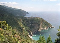
Landslide-inventory of the Cinque Terre National Park (Italy) and quantitative interaction with the trail network
Sign Up to like & getrecommendations! Published in 2019 at "Journal of Maps"
DOI: 10.1080/17445647.2019.1657511
Abstract: ABSTRACT The Cinque Terre National Park (38 km2) has recently recorded a remarkable increase in tourists involved in outdoor activities such as hiking. However, due to the actual slope degradation issues that affect this outstanding… read more here.
Keywords: landslide inventory; terre national; national park; cinque terre ... See more keywords

Geomorphologic landslide inventory by air photo interpretation of the High Agri Valley (Southern Italy)
Sign Up to like & getrecommendations! Published in 2021 at "Journal of Maps"
DOI: 10.1080/17445647.2021.1943552
Abstract: Landslide inventories provide the knowledge basis for many geomorphological applications and also planning and emergency management. Detailed landslide inventories should also be prepared where pre-existing inventories are available, as knowledge updates. In this paper, we… read more here.
Keywords: high agri; valley southern; agri valley; landslide inventory ... See more keywords

Automatic Landslide Inventory Mapping Approach Based on Change Detection Technique With Very-High-Resolution Images
Sign Up to like & getrecommendations! Published in 2020 at "IEEE Geoscience and Remote Sensing Letters"
DOI: 10.1109/lgrs.2020.3041409
Abstract: Landslide inventory mapping (LIM) plays an important role in landslide susceptibility analysis. Many LIM approaches based on change detection techniques have been proposed, but with various drawbacks. For example, existing approaches have limited capability to… read more here.
Keywords: high resolution; inventory mapping; change detection; approach ... See more keywords

Landslide Inventory Mapping on VHR Images via Adaptive Region Shape Similarity
Sign Up to like & getrecommendations! Published in 2022 at "IEEE Transactions on Geoscience and Remote Sensing"
DOI: 10.1109/tgrs.2022.3204834
Abstract: Landslide inventory mapping (LIM) is an important application in remote sensing for assisting in the relief of landslide geohazards. However, while conducting LIM tasks performing change detection analysis using bitemporal very high-resolution (VHR) remote sensing… read more here.
Keywords: adaptive region; shape similarity; region; landslide inventory ... See more keywords