Ground-Based High Spectral Resolution Lidar Observation of Aerosol Vertical Distribution in the Summertime Southeast United States
Sign Up to like & getrecommendations! Published in 2017 at "Journal of Geophysical Research"
DOI: 10.1002/2016jd025798
Abstract: As part of the Southeast United States based Studies of Emissions & Atmospheric Composition, Clouds & Climate Coupling by Regional Surveys (SEAC4RS), and collinear with part of the Southeast Atmosphere Study (SAS), the University of… read more here.
Keywords: high spectral; southeast; united states; southeast united ... See more keywords

An intercomparison of long‐term planetary boundary layer heights retrieved from CALIPSO, ground‐based lidar and radiosonde measurements over Hong Kong
Sign Up to like & getrecommendations! Published in 2017 at "Journal of Geophysical Research"
DOI: 10.1002/2016jd025937
Abstract: The planetary boundary layer height (PBLH) is a very important parameter in the atmosphere, because it determines the range where the most effective dispersion processes take place, and serves as a constraint on the vertical… read more here.
Keywords: calipso; ground based; hong kong; boundary layer ... See more keywords

The influence of particle concentration and bulk characteristics on polarized oceanographic lidar measurements
Sign Up to like & getrecommendations! Published in 2022 at "Limnology and Oceanography"
DOI: 10.1002/lno.12088
Abstract: Oceanographic lidar measurements of the linear depolarization ratio, δ, contain information on the bulk characteristics of marine particles that could improve our ability to study ocean biogeochemistry. However, a scarcity of information on the polarized… read more here.
Keywords: lidar measurements; influence; bulk characteristics; particle ... See more keywords

Multi‐temporal 3D point cloud‐based quantification and analysis of geomorphological activity at an alpine rock glacier using airborne and terrestrial LiDAR
Sign Up to like & getrecommendations! Published in 2019 at "Permafrost and Periglacial Processes"
DOI: 10.1002/ppp.2004
Abstract: Change analysis of rock glaciers is crucial to analyzing the adaptation of surface and subsurface processes to changing environmental conditions at different timescales because rock glaciers are considered as potentially unstable slopes and solid water… read more here.
Keywords: analysis; rock glacier; surface; lidar ... See more keywords

EIL‐SLAM: Depth‐enhanced edge‐based infrared‐LiDAR SLAM
Sign Up to like & getrecommendations! Published in 2022 at "Journal of Field Robotics"
DOI: 10.1002/rob.22040
Abstract: Traditional simultaneous localization and mapping (SLAM) approaches that utilize visible cameras or light detection and rangings (LiDARs) frequently fail in dusty, low‐textured, or completely dark environments. To address this problem, this study proposes a novel… read more here.
Keywords: slam; lidar; infrared lidar; edge based ... See more keywords

Wind profiling from high troposphere to low stratosphere using a scanning Rayleigh Doppler lidar
Sign Up to like & getrecommendations! Published in 2018 at "Optical Review"
DOI: 10.1007/s10043-018-0471-y
Abstract: A scanning mobile Rayleigh Doppler lidar based on the molecular double-edge technique is developed for wind measurement from high troposphere to low stratosphere in 5–35 km. To get higher optical efficiency and make the system more… read more here.
Keywords: rayleigh doppler; doppler; troposphere low; doppler lidar ... See more keywords

Scanning 3D-LiDAR based on visible laser diode for sensor-integrated variable distribution lighting
Sign Up to like & getrecommendations! Published in 2018 at "Optical Review"
DOI: 10.1007/s10043-018-0483-7
Abstract: A new concept of integrated systems, named “IoT station”, using laser scan technology with visible laser diodes (LDs) common to smart lighting and LiDAR is proposed. It is applicable not only for smart lighting but… read more here.
Keywords: scanning lidar; lidar based; based visible; lidar ... See more keywords

Recognition and mapping of lacustrine relict coastal features using high resolution aerial photographs and LiDAR data
Sign Up to like & getrecommendations! Published in 2017 at "Journal of Paleolimnology"
DOI: 10.1007/s10933-017-9956-0
Abstract: Shallow lakes in semiarid regions experience frequent water level fluctuations. Each long-lasting episode of water-level lowering leaves behind abandoned littoral forms and deposits whose identification and mapping is hampered by their smooth relief. Given the… read more here.
Keywords: relict coastal; high resolution; lidar; relict ... See more keywords

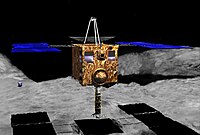
Dust Detection Mode of the Hayabusa2 LIDAR
Sign Up to like & getrecommendations! Published in 2017 at "Space Science Reviews"
DOI: 10.1007/s11214-016-0242-7
Abstract: We aim to use light detection and ranging (LIDAR) to detect dust grains that might be present around asteroid (162173) Ryugu (1999 JU3), the target of the Hayabusa2 mission. LIDAR is currently used for observing atmospheric aerosols… read more here.
Keywords: detection; hayabusa2 lidar; dust; return pulse ... See more keywords

Improving accuracy of LiDAR-derived digital terrain models for saltmarsh management
Sign Up to like & getrecommendations! Published in 2017 at "Journal of Coastal Conservation"
DOI: 10.1007/s11852-016-0492-2
Abstract: Accurate digital elevation models of saltmarshes are crucial for both conservation and management goals. Light detection and ranging (LiDAR) is increasingly used for topographic surveys due to the ability to acquire high resolution data over… read more here.
Keywords: ground; lidar derived; accuracy; management ... See more keywords

Mapping Seafloor Relative Reflectance and Assessing Coral Reef Morphology with EAARL-B Topobathymetric Lidar Waveforms
Sign Up to like & getrecommendations! Published in 2019 at "Estuaries and Coasts"
DOI: 10.1007/s12237-019-00652-9
Abstract: Topobathymetric lidar is becoming an increasingly valuable tool for benthic habitat mapping, enabling safe, efficient data acquisition over coral reefs and other fragile ecosystems. In 2014, a novel topobathymetric lidar system, the Experimental Advanced Airborne… read more here.
Keywords: mapping seafloor; topobathymetric lidar; seafloor relative; lidar ... See more keywords