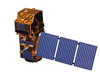
Contemporary comparative assessment of atmospheric correction influence on radiometric indices between Sentinel-2A and Landsat 8 imagery
Sign Up to like & getrecommendations! Published in 2019 at "Geocarto International"
DOI: 10.1080/10106049.2019.1590465
Abstract: Abstract Atmospheric correction is used to remove atmospheric effects on remotely sensed imagery, so it could change its properties and, in the end, all the derived results from it. The objective of this research was… read more here.
Keywords: imagery; index; landsat sentinel; atmospheric correction ... See more keywords