Assessment of the vegetation indices on Sentinel-2A images for predicting the soil productivity potential in Bursa, Turkey
Sign Up to like & getrecommendations! Published in 2019 at "Environmental Monitoring and Assessment"
DOI: 10.1007/s10661-019-7989-8
Abstract: Although field surveys represent an essential method for determining soil productivity, the use of remote sensing techniques has become a popular option over recent years due to its economic and practical applications. The fundamental basis… read more here.
Keywords: productivity; soil productivity; soil; vegetation indices ... See more keywords

Mapping the chlorophyll-a horizontal gradient in a cascading reservoirs system using MSI Sentinel-2A images
Sign Up to like & getrecommendations! Published in 2019 at "Advances in Space Research"
DOI: 10.1016/j.asr.2019.04.035
Abstract: Abstract In this work, we investigated the trophic gradient in three reservoirs cascading in Tiete River, Southeast Brazil, based on their chlorophyll-a (chl a) concentration. The goal of this study was to identify spatial patterns… read more here.
Keywords: system; sentinel images; mapping chlorophyll; msi sentinel ... See more keywords

Mapping sugarcane in complex landscapes by integrating multi-temporal Sentinel-2 images and machine learning algorithms
Sign Up to like & getrecommendations! Published in 2019 at "Land Use Policy"
DOI: 10.1016/j.landusepol.2019.104190
Abstract: Sugarcane is an important type of cash crop and plays a crucial role in global sugar production. Clarifying the magnitude of sugarcane planting will likely provide very evident supports for local land use management and… read more here.
Keywords: machine learning; sugarcane; study; phenology ... See more keywords

Rapid, robust, and automated mapping of tidal flats in China using time series Sentinel-2 images and Google Earth Engine
Sign Up to like & getrecommendations! Published in 2021 at "Remote Sensing of Environment"
DOI: 10.1016/j.rse.2021.112285
Abstract: Abstract Tidal flats are threatened by tidal reclamation and climatic changes around the world. Particular challenges exist in China where tidal flats are changing rapidly along with accelerated economic development in coastal regions. The unique… read more here.
Keywords: tidal flats; tidal flat; sentinel images; spatial resolution ... See more keywords

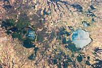
Estimating vulnerability of water body using Sentinel-2 images and environmental modelling: the study case of Bracciano Lake (Italy)
Sign Up to like & getrecommendations! Published in 2019 at "European Journal of Remote Sensing"
DOI: 10.1080/22797254.2019.1689796
Abstract: ABSTRACT Due to the concomitance of several factors related to progressive climate changes and to increased water management for anthropogenic usage, drastic fall in level of Bracciano Lake, a volcanic lake, 30 km northwest of… read more here.
Keywords: water body; water; bracciano lake; vulnerability ... See more keywords

A Comparative Analysis of Index-Based Methods for Impervious Surface Mapping Using Multiseasonal Sentinel-2 Satellite Data
Sign Up to like & getrecommendations! Published in 2021 at "IEEE Journal of Selected Topics in Applied Earth Observations and Remote Sensing"
DOI: 10.1109/jstars.2021.3067325
Abstract: Studies have shown that Sentinel-2 images have advantages over Landsat images in impervious surface area (ISA) extraction. The performance of index-based methods can be affected by different binary methods and subject to seasonal variation. This… read more here.
Keywords: impervious surface; based methods; sentinel images; index based ... See more keywords

Dynamic Retrieval of Olive Tree Properties Using Bayesian Model and Sentinel-2 Images
Sign Up to like & getrecommendations! Published in 2021 at "IEEE Journal of Selected Topics in Applied Earth Observations and Remote Sensing"
DOI: 10.1109/jstars.2021.3110313
Abstract: The goal of this study is to provide a fine detection and monitoring of olive orchard trees over large areas to anticipate any damage. We developed an original method to assess the spatiotemporal dynamics of… read more here.
Keywords: retrieval olive; sentinel images; model; olive tree ... See more keywords

Attentional Dense Convolutional Neural Network for Water Body Extraction From Sentinel-2 Images
Sign Up to like & getrecommendations! Published in 2022 at "IEEE Journal of Selected Topics in Applied Earth Observations and Remote Sensing"
DOI: 10.1109/jstars.2022.3198497
Abstract: Monitoring water bodies from remote sensing data is certainly an essential task to supervise the actual conditions of the available water resources for environment conservation, sustainable development, and many other applications. Being Sentinel-2 images some… read more here.
Keywords: water; extraction; convolutional neural; dense convolutional ... See more keywords

Chlorophyll-a Retrieval From Sentinel-2 Images Using Convolutional Neural Network Regression
Sign Up to like & getrecommendations! Published in 2022 at "IEEE Geoscience and Remote Sensing Letters"
DOI: 10.1109/lgrs.2021.3070437
Abstract: In this letter, we explore harnessing the power of regression-oriented convolutional neural networks (CNN) for the assessment of surface water quality from remote sensing images. They are used to estimate the chlorophyll-a concentration of Lake… read more here.
Keywords: regression; tex math; convolutional neural; sentinel images ... See more keywords

Aerosol Retrieval Algorithm for Sentinel-2 Images over Complex Urban Areas
Sign Up to like & getrecommendations! Published in 2022 at "IEEE Transactions on Geoscience and Remote Sensing"
DOI: 10.1109/tgrs.2022.3158061
Abstract: High-resolution aerosol retrieval is of great significance for understanding the impact of aerosols on air pollution and climate change. In this study, an algorithm for aerosol retrieval at a spatial resolution of 60 m over… read more here.
Keywords: sentinel aods; urban areas; aerosol retrieval; retrieved sentinel ... See more keywords

Sentinel-2 Images for Effective Mapping of Soil Salinity in Agricultural Fields
Sign Up to like & getrecommendations! Published in 2021 at "Current Science"
DOI: 10.18520/cs/v121/i3/384-390
Abstract: Salinity is a critical feature for the management of agricultural soil, particularly in arid and semi-arid areas. The present study was conducted to develop an effective soil salinity prediction model using Sentinel-2A (S2) satellite data.… read more here.
Keywords: effective mapping; soil; sentinel images; soil salinity ... See more keywords